Foreigners other than Indian citizen, who intend to visit Nepal must hold a valid passport prior to applying for a Nepal visa. The passport must have six months validity from the date of arrival. Foreigners can obtain a Nepalese visa upon arrival at Kathmandu airport, or at a border immigration office. One recent copy of a passport size color photo is required to apply for Tourist Visa to Nepal. Mountain Mart Trek has listed Nepal visa information tips for travelers to Nepal.
Tourist visas shall be granted for a maximum period of 150 days in a visa year (January to December)
A foreigner who has departed before the expiry of the period specified in the visa issued in a visa year shall not be allowed to use the visa by adding the remaining period to another visa year. If any foreigner who has entered Nepal towards the end of a visa year desires to extend his/her stay into the new visa year, he/she may do so by purchasing another visa for the New Year. Provided, however, that the computation of the fees for such period shall be made on the basis of the total period of the stay.
An application for a Tourist Visa must be submitted in the format referred to in Appendix 1.
A Nepali visa issued abroad is valid for entry for three to six months from the date of issue. True -
Tourist Visa Exceptions
Citizens of the following countries should be issue visa in their own country to Nepal embassy and consulate.
Afghanistan, Cameroon, Ethiopia, Ghana, Iraq, Liberia, Nigeria, Palestine, Somalia, Zimbabwe.
Entry
No foreigners except Indians are entitled to Nepal without a valid visa.
Visas can be obtained from the following immigration offices in Nepal:
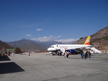
- Tribhuvan International Airport, Kathmandu
- Kakarvitta, Jhapa (Eastern Nepal)
- Birganj, Parsa (Central Nepal)
- Kodari, Sindhupalchowk (Northern Border)
- Belhiya, Bhairahawa (Rupandehi, Western Nepal)
- Jamuna, Nepalgunj (Banke, Mid Western Nepal)
- Mohana, Dhangadhi (Kailali, Far Western Nepal)
- Gaddachauki, Mahendranagar (Kanchanpur, Far Western Nepal)
Visa Application Forms
A copy of the Visa Form is available for use at the end of this document that avoids you long queue to pick up the Nepal visa form at the international airport.
Visa Fees
The fees payable only in USD dollars for obtaining a visa on arrival at any border are as follows:
- A Tourist Visa with Multiple Entry for 15 days: US$ 25 payable only in USD dollars.
- A Tourist Visa with Multiple Entry for 30 days: US$ 40 payable only in USD dollars
- A Tourist Visa with Multiple Entry for 90 days: US$ 100 payable only in USD dollars
- Regardless of the provisions stated in points E1 and E2 above: Tourists with passports from South Asian
Association for Regional Cooperation (SAARC) countries (Bangladesh, Bhutan, India, Maldives, Pakistan
and Sri Lanka) are not required to pay visa fees for a 30 day visa.
- Indian citizens do not require a visa to enter into Nepal.
Visa Extension Fees
The fees payable (only in local Nepali currency) to extend the duration of your stay, or to renew a visa are:
- US$ 2 equivalent, in Nepali currency, per day of the extension period.
- An additional US$ 20 or equivalent, in Nepali currency, is payable on a single-entry visa in F1 if a MultipleEntry facility is requested for the extended period.
- If foreign visitors failed to renew their visa and need to do so at an exit point, they have to pay an additional equivalent to US$ 3, in Nepalese currency, on the regular visa extension fee.
- Foreign visitors who have overstayed their visa period of 150 days without extension are required to pay an additional visa fee as per provision in F3, plus a fine as specified in Clause 10 sun-clause 4 of the immigration Act 2049.
- Regardless of the provision stated in F1: 15 days is counted as a minimum extension period and the visa fee is charged accordingly. For an extension period of more than 15 days, the visa fee is charged as per the provision of F1.
- A tourist visa can be extended for up to a maximum period of 150 days in a single visa year (Jan. – Dec.).
It is cheaper to purchase a 30 day visa at the point of entry and then to extend it, for 15 days or more at the Central Immigration Office in Kathmandu or Pokhara unless you are staying for 90 days or more
For an extension to a visa you will need two additional passport photographs for each extension.
Transit Visa
A transit visa for one day can be obtained from Nepal's immigration offices at an entry point upon the production of a departure flight ticket via Tribhuvan International Airport in Kathmandu. The fee is US$ 5 or equivalent convertible currency. A transit visa may not be extended.
A Nepali Visa can be obtained from Nepal Embassy / Consulate Offices in your country, or upon arrival at Kathmandu airport. It is also possible to obtain the visa from other border points of entry. You'll need 1 passport photo each time.
For foreign investors, a business visa with a multiple entry facility for a period of one year or five years can be obtained from the Department of Immigration on the recommendation of the Department of Industry and Commerce by paying US$ 100 and US$ 250 or equivalent convertible foreign or Nepali currency.
Note: While we try to make the information contained herein as accurate as possible, we accept no responsibility for any loss, disruption or inconvenience sustained by anyone using this information.
Important Information to Visitors
Foreign visitors are requested to keep a note of the dates on their Nepalese visa and their passport number to avoid possible problems. Visa extensions need to be applied for, within the valid period of the Nepalese visa.
You are requested to ensure that you get the arrival/departure stamps on your passport at the entry /exit points to avoid possible legal complications.
Living in Nepal without a passport or a valid visa is a punishable offence.
Deviation from the prescribed trekking routes mentioned on your trekking permit will be treated as a violation of the law.
You are advised to be aware of brokers/cheaters and counterfeit documents or visa/trekking permits to avoid legal complications.
Change of purpose of your stay without permission is not allowed and employment or voluntary services while on a tourist visa is strictly prohibited. It will be a punishable offence.
Be certain to register at the police and Immigration check points along any trail. It would be wise to register your trekking destination and schedule at your Embassy or Consulate.
If you encounter problems along the trails, immediately inform the nearest police or Immigration post officials.
You are requested to change money with recognized dealers and do not forget to take and keep formal receipts.
You are requested to inform the officials at an Immigration Office or Police Station of any changes in the address previously given in your visa application form or disembarkation card, and within seven days.
If, as a tourist, your stay is more than 120 days in one visa year and you wish to visit additional places for longer than 24 hours, you must register at the local police office of such places, your name, passport number and address.
You are advised to be mindful to contact the Department of Immigration to request a visa transfer in the case of getting a new passport or travel document from your embassy, and within seven days.
Passport and trekking permits should be kept by each trekker while trekking.
Filming in restricted or notified areas without permission is strictly prohibited.
Please do not take out the visa stickers from your passport and do not try to change records printed in your passport.
We request your co-operation in observing the following guidelines during your stay in Nepal. Respect local traditions, customs, values and sentiments, help to protect local culture and maintain local pride.
- Respect privacy while taking photographs.
- Respect holy places.
- Refrain from giving money to children as it will encourage begging.
- Respecting local etiquette will earn you respect.
Let the Himalayas change you – do not change them: so remember while you are on trekking:
- Leave campsites cleaner than you have found them.
- Do not light open fires.
- Burn dry papers and packets in a safe place.
- Keep local water clean and avoid using pollutants.
- Plants should be left to flourish in their natural environment.
- Help your guides and porters to follow conservation measures.
- Protect the natural environment.
Information for Indian Citizens
Indian citizens are permitted to travel in Nepal provided they have any one of the following documents:
Passport; Driving license with photograph; Identity card with photograph issued by a governmental body; Ration card with photograph; Voter identity card with photograph; Registration certificate issued by the Indian embassy to Indian citizens residing in Nepal; Ad hoc/temporary identity cards issued by the Indian embassy to the Indian citizen in the event of exigency; Document with photograph and setting out identity, issued by the sub-divisional magistrate or authority there above.
General Information
Department of Immigration
Kalikasthan, Dillibazar, Kathmandu. |
| Tel : |
977 - 01 - 4433934 / 4429660 / 4438862 / 4438868 |
| Fax : |
977 - 01 - 4433935 |
| Email : |
mail@nepalimmigration.gov.np |
| Web : |
http://nepalimmigration.gov.np/ |
Office Hours
| Sunday to Thursday |
10:30 a.m. - 17:00 p.m. in Summer |
| |
10:30 a.m. - 16:00 p.m. in Winter (Nov. to Jan.) |
| Friday |
10:30 a.m. -15:00 p.m. |
Visa Application Hours
| Sunday to Thursday |
10:30 a.m. - 15:00 p.m. |
| Friday |
10:30 a.m. - 13:00 p.m. |
Note: All of the information above is based on information from the Department of Immigration of Nepal’s office and may be found on their website.
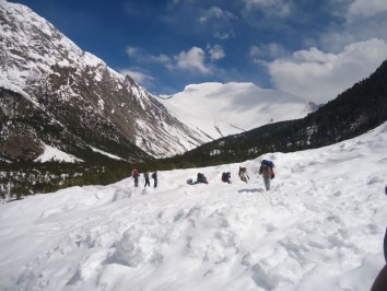
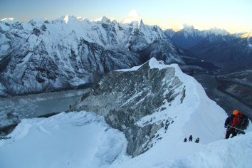
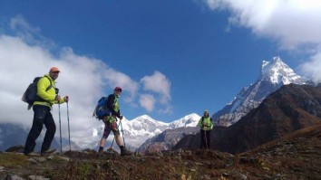
Trekking cards and Permits for Conservation Areas, National Parks and Restricted Areas
All trekkers are required to carry a Trekkers' Information Management System card (TIMS card). It is available from the Tourist Services Centre in Kathmandu: Sun – Fri 10:00 – 13:00 and 14:00 – 17:00. It is free, but requires two passport photographs. (Trekking agencies provide the cards for their clients.) Show it at check points on trekking routes.
Trekking Permits are required for all treks that pass through Conservation Areas or National Parks.
Conservation Area permits can be purchased at the Tourist Services Centre for Rs 2000 plus two photographs.
National Park entry tickets cost Rs 3000 and require no photograph. Purchase at the Department of National Parks and Wildlife Conservation office Sun – Fri 09:00 – 14:00 only (next to the Tourist Services office).
Restricted Area Permits are required mainly for camping style trekking in remote areas near the Tibetan border – for which a guide is strongly recommended. They can only be purchased for two or more trekkers. The permits are issued by the Central Immigration Office, require two working days, your original passports (not facsimiles) and two photographs. Costs range from US$10/week to US$500/10 days plus substantial additional amounts for each additional day. These will be procured by your chosen trekking agency. Offices are open daily, but with restricted hours on Saturdays.
Tourist Visa
The foreign tourist visiting Nepal shall be granted the tourist visa.
The tourist visa shall be granted for a period in maximum of 150 days in a visa year (Visa years means January to December).
A tourist who has departed before the expiry of the period specified in the visa issued in a visa year shall not be allowed to use the visa by adding the remaining period to another visa year.
If any foreigner who has entered into Nepal towards the end of a visa year desires to spend even the period during which he may stay in Nepal with the tourist visa of the other visa year, he may use such facility.
Provided, however, that the computation of the fees for such period shall be made on the basis of the total period of his stay.
Note: Above information is based on Department of Immigration of Nepal office.